Page
Topography
Completion requirements
View
Topography: Refers to the ‘lie of the land, or the physical and geographic characteristics of the land in terms of elevation, slope and orientation, or aspect (facing north).
An understanding of topography is critical for a number of reasons. In terms of environmental quality, agriculture, and hydrology, understanding the topography of an area enhances the understanding of watershed boundaries, drainage characteristics, water movement and water quality.
Understanding topography also aids in soil conservation, especially in agriculture. Contour ploughing, which is the practice of ploughing along the topographic lines, is an established practice of enabling sustainable agriculture on sloping land.
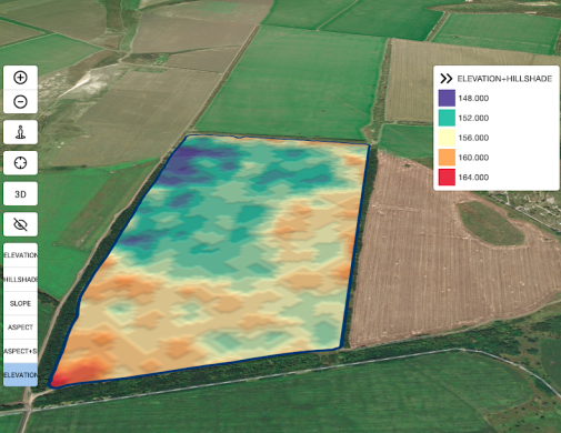
When planning planting areas, an understanding of topography is important when deciding on the placement of the field, orchard, and row direction, keeping the effect of irrigation runoff and stormwater management in mind.
The direction the slope faces is important, as those facing north receive more sunlight. The angle of the sun’s rays also changes, especially in more southern areas.
In windy areas, planted areas at the top of a hill facing the prevailing winds will suffer much more wind damage than one on the lee side of the hill.
Topography is also important in determining weather patterns. Two areas in fairly close proximity may differ radically in climatic characteristics, such as rainfall, because of elevation differences or position relative to a nearby hill or mountain range. It is also well known that topography influences the occurrence of hail with the incidence of hail on two farms relatively near to each other differing greatly.
Knowledge of the possible effects of the topography on the development of a specific farm can therefore have a strong bearing on the eventual profitability of the plantings.