Principles of Site Selection
To evaluate the farm in its whole, it will be necessary to draw a map indicating the farm’s topography, boundaries as well as soil and water resources. This is essential information needed in the planning process when selecting a site for a specific purpose, e.g. building a dam or waterway, the layout of a new land etc. North – eastern slopes are preferred for maximum sunlight, warmth and protection from winds. Slopes do have a tendency to erosion and need to be cultivated with care. Soil erosion can be prevented by not using slopes with a gradient of more than 7º when cultivating for crops.

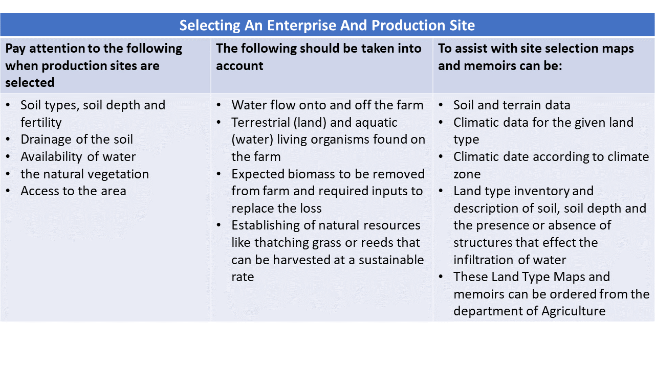
Pay attention to the following when production sites are selected:
- Soil types, soil depth and fertility
- Drainage of the soil
- Availability of water
- the natural vegetation
- Access to the area
During the process of selecting an enterprise on the farm one will also take into account the information regarding natural resources and the specific needs for the different enterprises. The natural resource base must be able to sustain the selected enterprise.
The following should be taken into account:
- Water flow onto and off the farm.
- Terrestrial (land) and aquatic (water) living organisms found on the farm.
- Expected biomass to be removed from farm and required inputs to replace the loss.
- Establishing of natural resources like thatching grass or reeds that can be harvested at a sustainable rate.
Site selection is important to ensure that cost is kept at a minimum. Correct drainage can take place, runoff water can be controlled. In the case of feedlots or dairies where a large number of animals are kept in camps the drainage and runoff of water is very important. The site for animals and animal products must also be away from water sources to prevent pollution of the underground water. In the case of certain fruit trees, the slope of the hill and the amount of sunlight and heat units will play a role in the quality of the fruit or product.
To assist with site selection the land type maps and memoirs from the Department of Agriculture can be used to give detail about the following:
- Soil and terrain data
- Climatic data for the given land type
- Climatic date according to climate zone
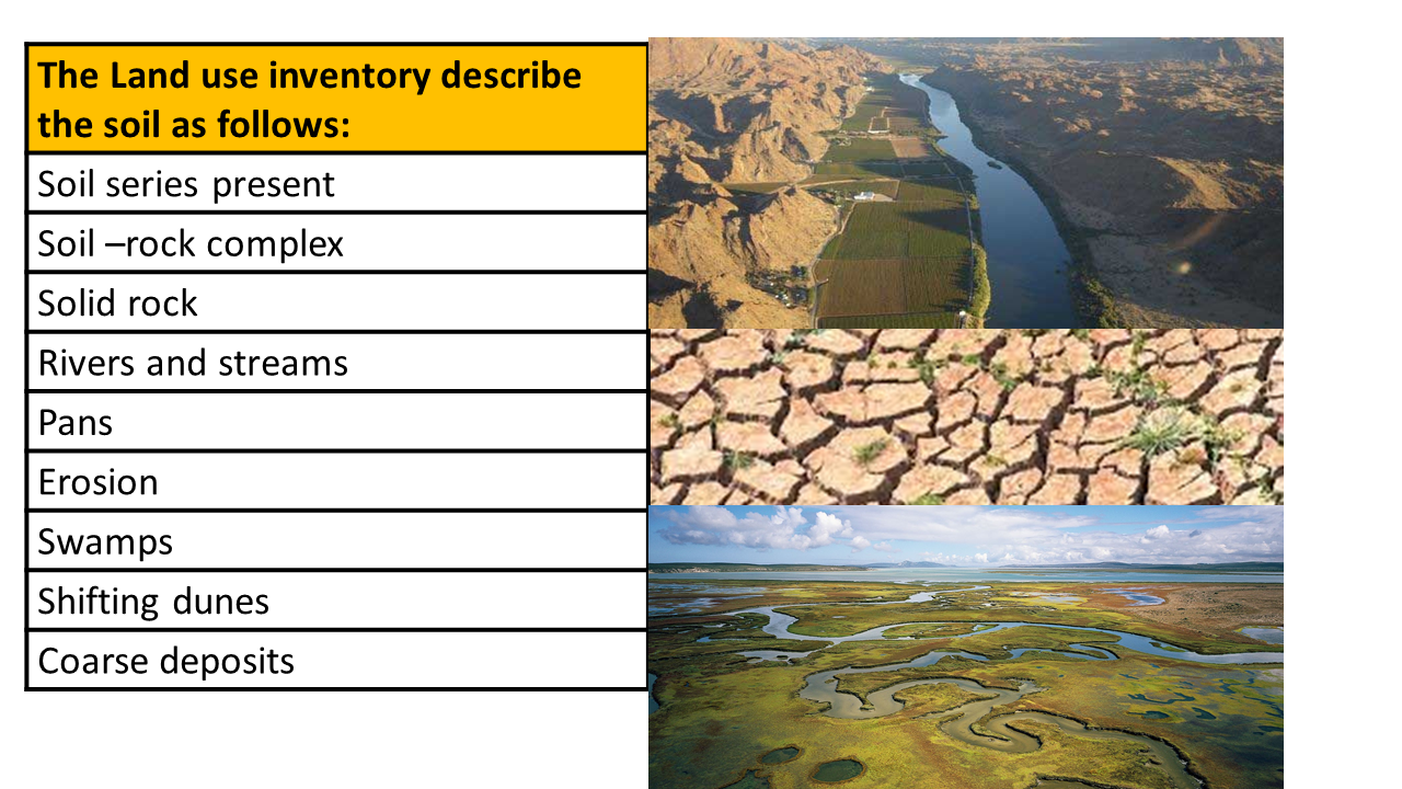
- Land type inventory and description of soil, soil depth and the presence or absence of structures that effect the infiltration of water.
- These Land Type Maps and memoirs can be ordered from the department of Agriculture. Division of Agricultural information. Private bag x 144 Pretoria.
When a Land Type Map is ordered for e.g. 2623 Vryburg, then request for a 1:250 000 LAND TYPE SERIES 2623 VRYBURG with accompanied memoirs. The Land type maps and information is also available at www.agis.agric.za. The land type inventory is compiled by the Department of Agriculture and provides information regarding the following:
- Terrain – a profile sketch indicating the highest and lowest point as well as the different slopes
- Percentage level land is estimated
- The local relief is also estimated
- Terrain units are also indicated
- The Geology
- Soil depth, soil series (soil with slopes of less than 12 % and no mechanical limitations are indicated as plough-able soil) • Climate zones are indicated
- Rainfall indicated
- Evaporation as measured in class A- evaporation pan
- Temperature – heat units, highest and lowest temperature
- Frost – the first day and the last day and the duration of the frost period
Site Selection and the Conservation Of Natural Resources
With the selection of a production site the various internal factors such as topography, soil and climatic factors need to be considered. One must also keep in mind the natural vegetation and the ecology of the area, determine (by means of ecological studies) if this area is not an ecological sensitive area where cultivation is prohibited e.g. vlei areas or where the slopes are too steep.

Mechanical limitations associated with each class of land are described in terms of the classes set out below. The limitations are due to the size and quantity of stones and/or depth or shallowness of tillable soil.
MB0 – No mechanical limitations
MB1 – Many stones, but plough able
MB2 – Large stones and boulders, un-plough able
MB3 – Very shallow soils on rock
MB4 – Lack of soil
The Profile Description Method
This method is based on the Soil Survey Manual (1951) and describes the following:
Stone Size and Quantity
Stones larger than 250 mm in diameter and rock projections are grouped together since both of them have an effect on soil use, e.g. interfering with the use of agricultural machinery and dilute the soil mass.
Class 0 – No stones or bedrock or too few stones to interfere with tillage
Class 1 – Sufficient stones or bedrock to interfere with tillage, but not to make inter-tilled crops impracticable
Class 2 – Sufficient stones or bedrock to make tillage of inter-tilled crops impracticable, but soils can be worked for hay crops or improve pasture if other soil characteristics are favourable
Class 3 – Use of all but very light machinery and hand tools impracticable, forestry and grazing possible
Class 4 – Use of all machinery impracticable, forestry and grazing possible
Class 5 – More than 90% of the land surface covered by stones or exposed bedrock.
Erosion
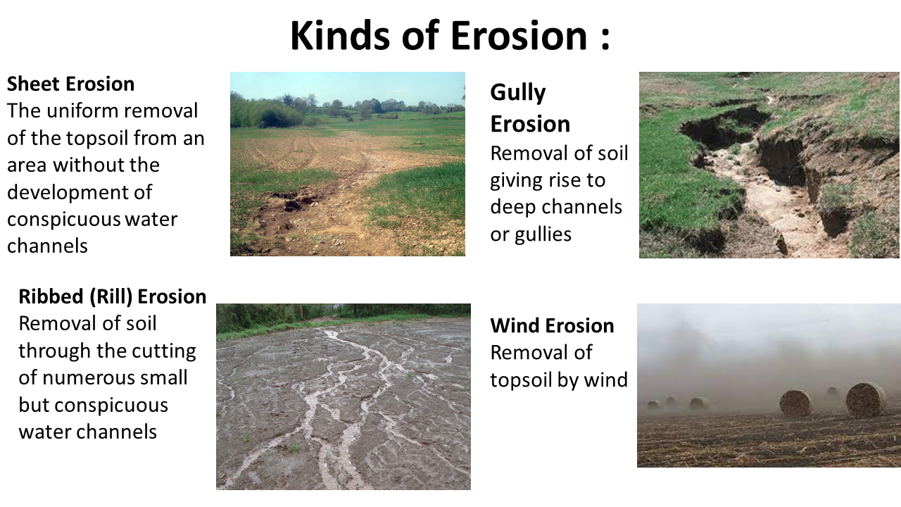
The different kinds of erosion can be described as follows:

Different classes of erosion:
Class 1: None apparent or slight
Class 2: Moderate loss of topsoil and/or some slight dissection by runoff channels or gullies
Class 3: Severe loss of topsoil and/or marked dissection by runoff channels or gullies
Class 4: Total loss of topsoil and exposure of subsoil and /or deep intricate dissection by gullies
Basic Infrastructure Layout Requirements
The layout of a farm is planned according to the activities that will be implemented, the structures and infrastructure required by these activities, also the natural resources and natural landscape of the area. Health regulations and the Occupational Health and Safety Act (OHS Act) must also be taken into consideration with the planning of Agricultural facilities. The list below provides a few examples of structures and infrastructure that could form part of a farm. It is impossible to provide a list that is applicable to every farming enterprise.
|
Layout Requirements and Considerations |
|
|
Access / transport |
Farm produce must be transported from the farm to markets and silos while inputs are brought onto the farm. Consider the distance that must be travelled and the condition of the roads. Make sure access roads can be used in wet weather conditions to prevent damage to vehicles and produce. |
|
Beehives |
Keep away from people. Must be close to forage and water sources. Needs sheltered areas; protection from wind. |
|
Borehole |
Situated at underground water source – consider how water will be pumped to where it is needed. |
|
Bridges |
Make sure these do not interfere with wetlands. Take maximum flood levels into account. Make provision for water to flow underneath without blockage. |
|
Compost heaps |
Close to material and water source. Ease the transportation of end-product to where it will be used or sold. Facility to sieve and do the packaging. |
|
Cattle handling facilities |
Close the other cattle facilities (kraal). Ensure safe handling and movement for animals and handlers during a working (e.g. selection) process. |
|
Dams |
Preferably higher than the area to where water will be used so that water can be gravity fed. Ideal sites for catching excess rainwater and to block up streams or rivers. |
|
Electrical generator |
Consider noise and length of cables. Alternative sources for electricity or heating –solar heating. |
|
Farmhouse |
In an unproductive area, but centrally located on the farm to save on transport costs. Ideally also placed for good visibility, such as to look out for fires. |
|
Fencing |
Separating specific activities on the farm, different grazing camps and security. |
|
Fields\lands |
In areas with high productive possibilities, but consider access routes, slopes and soil types, contours and water ways. |
|
Firebreak |
On the boundary where fire is likely to come from. Take legal requirements into account. |
|
Food stores |
Closest to where the animals are fed. Safe from fires. |
|
Grazing |
Consider the suitability of grazing areas. Divide into camps based on herds and carrying capacity. In areas where tilling (ploughing) is impossible. |
|
Input stores |
Closest to where it will be used. Consider storage requirements of materials, e.g. temperature, humidity, etc. OHS act in handling of chemicals and flammable products. |
|
Intensive food garden |
If appropriate, nearest the farmhouse. |
|
Irrigation |
Access to water is crucial for success of any farm. To save on installation costs, the use of gravity-fed systems should be exploited to the maximum to keep the need for pumps to a minimum. |
|
Milk sheds / milking parlour |
Consider input requirements, electricity and water. Consider walking distance for cows to-and-from the milk sheds. Transportation of milk to dairies (e.g. Clover, Dairy Bell). Health regulations need to be obeyed. |
|
Nursery / greenhouse |
Access to water, inputs, electricity. Consider transport of produce to market. Keep wind direction and temperature in mind. Biosecurity. |
|
Orchard |
Access to water and pack house. Consider theft and pollination. Climatic conditions need to be taken into account with some fruit cultivars. Biosecurity. |
|
Pack house |
Consider proximity to fields, orchards and place of production. Consider condition of the road (bruised fruit, etc.). |
|
Poultry shed |
Access to water and proximity to feed. What about slaughter options; if on site, then electricity and storage must be considered. Theft - security. Bio- very important. Health requirements. |
|
Water reservoir |
How is water pumped, and how far? The longer the distance, the higher the capital and maintenance costs. |
|
Windbreak |
At right angles to the prevailing wind. |
|
Woodlot |
Keep away from fire hazards. |
|
Workshop |
Closest to where vehicles are stored. Enough space to work on farm machines. Layout and neatness according to OHS Act. |

- The financial position of the owner
- The different farming enterprises
- The production systems used to produce a product.
- The topography of the farm
- The intensity of the system
- The climatic conditions of the farm
- The product produced
- Rules and regulations applicable to agricultural sector.
Infrastructure influence productivity, yield, cost, quality and other agricultural inputs in the following ways:
- Better infrastructure will ensure a better-quality product.
- Yields can be enlarged due to the better management and application of the necessary inputs.
- The cost can be controlled as the damage to products is reduced and better infrastructure make it easier to achieve the production goals