Page
Crop Ecotope Classification System
Completion requirements
View
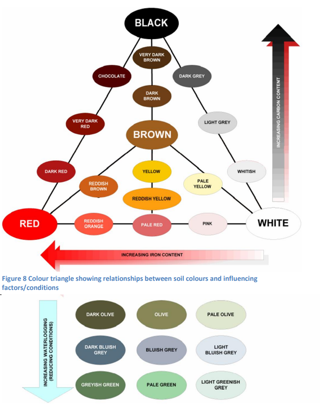
An ecotope is an area of land within which the variation in natural resources is limited to the degree that the production and palatability will be uniform and will differ from adjoining ecotopes. Crop ecotopes should be defined where, for instance, a Hutton, Clovelly, Griffin, and an Oakleaf soil produce similar crop yields under the same management. These soils would be grouped as one ecotope. To identify ecotopes, it is not necessary to have the knowledge of a pedologist. All that is required is the ability to identify five soil colours (red, yellow-brown, black, grey and mottled), to measure the effective depth, to assess the soil texture and structure, and to recognise the amount of wetness.
For example, an ecotope with the code B.2.1 would represent a soil with good drainage, a clay percentage of 15-35% in the topsoil, and an effective depth of more than 800mm. The slope would be less than 12% and the area is not rocky.
An ecotope with the code H.2.3.s.r represents a young soil profile (not highly weathered) with a clay percentage of 15-35% in the topsoil and an effective depth of 300-500mm. The ecotope is steep (12-40% slope) and rocky. The ecotope is not considered arable.
Symbols for the Classification of Crop Ecotopes
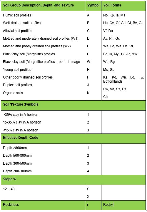
Note: Duplex soils have relatively permeable topsoil, changing abruptly to relatively impermeable topsoil. Margalit is an A horizon that is dark coloured with a high base status. The E horizon overlies a B horizon that is poorly drained and will prevent the damage of water through it. The water then runs sideways along the top of the bottom B horizon and leaches out nutrients to leave a grey-coloured zone (E horizon).